
March of the Elephants
When you think of elephants, you may immediately think of their defining characteristics: trunks, big ears, tusks. Or you may think about how they live in large family groups and are very social. You may even think about the story of the blind men and the elephant. You probably don’t think about them as engineers of their ecosystem. But they are.
Elephants are native to the Serengeti ecosystem, but Serengeti elephants were likely all killed off for ivory in the 1800’s. At least, there weren’t any recorded there until the middle of the twentieth century when they started moving back in again. In the 1960’s they migrated in from both the north and the south, and by 1970 there were over 3,000 elephants in the Serengeti. Things got rocky for elephants again in the 1980’s as severe poaching reduced their numbers in Serengeti National Park to around 500. In 1988, elephants were given CITES endangered species status and worldwide trade in ivory was banned. This was good news for Serengeti elephants and their numbers rebounded again into the thousands.
These ups and downs in elephant population have allowed scientists to study the impact elephants have on their environment. I’ve written before about how the rainfall patterns in the Serengeti affect grasses, and about the role that fire plays. Elephants have their greatest impact on trees. Elephants eat both grasses and trees, but depend on trees for food during the dry season.
In the first half of the twentieth century, the number of trees per hectare was slowly declining across the Serengeti. But starting in the 1970’s, the number of trees rapidly increased. Scientists believe that the initial decrease in trees was due to the the disease rinderpest. Rinderpest killed off the majority of Serengeti’s wildebeest, allowing the grass to grow tall, and fueling huge, strong fires. These fires killed most tree seedlings, meaning that as trees died, they were not being replaced. When rinderpest was halted, the wildebeest population exploded, and the wildebeest kept the grass short and the fires smaller, allowing trees to gain a foothold once more.
Okay, but what about elephants? Well, elephants eat trees — especially small, tender saplings and regrowth from trees damaged by fire. In the 1980’s, while poaching was particularly severe on the Tanzanian side of Serengeti (Serengeti National Park), the Kenyan part of Serengeti (Maasai Mara) mounted a strong anti-poaching effort and kept its elephant numbers high. Across the Serengeti, the trees were increasing, but in the Maasai Mara there were also a lot of elephants. It turns out that in the Maasai Mara, the trees didn’t increase like they did across the border in Tanzania where the elephants had been greatly reduced. Instead the high number of elephants in the Maasai Mara is keeping tree numbers down, despite the reduction in fire intensity.
So elephants are key players in maintaining what scientists call “alternative stable states” in the Serengeti. While there are plenty of elephants once again in the Tanzanian part of the Serengeti, they don’t reduce the higher tree numbers; only fire can do that. But on the Kenyan side of the border, tree numbers remain low because elephants there have been continuously eating saplings; the tree population cannot increase because of the constant elephant pressure. The key difference between the two areas is simply their history.
I think the fourth blind man should get extra credit.
The Fourth reached out an eager hand,
And felt about the knee
“What most this wondrous beast is like
Is mighty plain,” quoth he:
“‘Tis clear enough the Elephant
Is very like a TREE!”

Trees
The rain is crazy. Not as windy as yesterday, when it blew our furniture off the veranda, but crazy nonetheless. I could see it coming, not just your typical clouds stretching to the earth in the distance – I could see the waves of water hitting the ground between the scattered trees, moving closer with every second. It was a race – I wanted to reach the valley, with its low profile and scattered trees, before the storm reached me. I know that in a lightening storm, you’re not supposed to seek shelter beneath a tree. But in my giant Landrover, with its 4.5 foot antennae beckoning to the sky, I don’t like being the only blip on the plains. Logical or not. (Comments from lightning experts welcome.)
And so here I am. Somewhere between cameras L05 and L06, hunkered down as the torrents of water wash over Arnold & me. The endless tubes of silicone sealant have done their job – most of me, and most of my equipment, is dry – there are only two leaks in the roof.
The sky is gray for miles – I am done for the day. It’s only 5pm! In wet season, I can normally work until 7pm, and still prep my car for camping before it’s too dark to see. Today feels like one of those cherished half-days from elementary school – not as magical as a snow day, mind you, but exciting nonetheless. Except I am trapped in my car…
So, with that, I open a beer, shake out the ants and grass clippings from my shirt, and hunker down in the front seat to wait out the rain. And to think. I’ve been thinking a lot about trees lately. Mostly what they mean for the how the carnivores are using their landscape.
See, from the radio-collaring data, we know that lions are densest in the woodlands. Living at high densities that is, not stupid. But the cameras in the woodlands don’t “see” lions very well. Out on the plains, a lone tree is a huge attractant. It’s the only shade for miles, the only blip on the horizon. All the carnivores, but expecially the musclebound, heat-stressed lions, will seek it out. In contrast, in the woodlands, even though there are more lions, the odds of them walking in front of the one of 10,000 trees that has my camera on it are…slim.
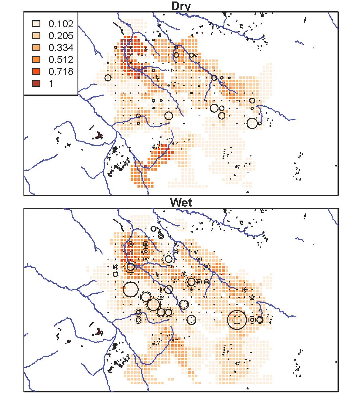
This map is one of many I’ve been making the last week or so. Here, lion densities, as calculated from radiocollar data, are the red background cells; camera traps are in circles, sized proportionally to the number of lions captured there. As you can see, the sheer number of lions captured in each camera trap doesn’t line up especially well with known lion densities. Disappointing, but perhaps unsurprising. One camera really only captures a very tiny window in front of it – not the whole 5km2 grid cell whose center it sits in. One of my goals, therefore, is to use what we know about the habitat to align the camera data with what we know about lion ranging patterns. I think the answer lies in characterizing the habitat at multiple different spatial scales – spatial scales that matter to the decision-making of a heat-stressed carnivore who sees blips on the horizon as oases of shade. And so I’m counting trees. Trees within 20 meters, 50 meters, 200 meters of the camera. One tree in a thick clump is still pretty attractive if that clump is the only thing for miles. Once I can interpret the landscape for lions, once I can match camera data with what we know to be true for lion ranging, I can be comfortable interpreting patterns for the other species. I hope.
The rain is letting up now, and it’s getting dark. Time to pack the car for camping – equipment on the roof and in the front seat. Bed in the back. And a sunset to watch with beer in hand.
Rainfall Patterns in the Serengeti
It’s a cold rainy day here in Washington D.C. where I’m writing. If I’m thinking seasonally, the key word here is cold, not rainy. It’s winter and winter is cold, but not always rainy. Spring, summer, and fall are warmer, but it rains throughout them all. By contrast, seasons in the Serengeti are marked by rainfall and not temperature.

A thunderstorm arrives
In January in the Serengeti, the long rains are beginning. In some years they start as early as December, and in other years they don’t really pick up until February. During the long rains, there are thunderstorms most days, but they don’t last all day long. There is still plenty of sunlight, and during this time the grasses start growing in earnest.
There are two water sources for the rainfall in the Serengeti. First is the Indian Ocean to the east. During the rainy season, the dominant winds are blowing from the warm ocean to land and bringing with them evaporated ocean water. As the air cools over the land, the water condenses as rain. In addition to water from the ocean, some rainfall in the Serengeti originates from Lake Victoria to the northwest.
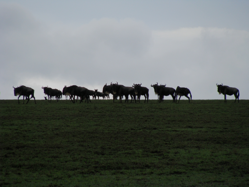
When the long rains come, the thirsty plains soak up the water and spring to life. Parched chalky brown land suddenly becomes a luscious green, and the migratory animals are drawn to the fresh grass. Over a million wildebeest, zebra, and Thomson’s gazelle appear on the open plains, and their presence draws the attention of lions and hyena, some of whom commute to the plains during the day and return home to the savanna at night.
The plains at the beginning of the long rains
The long rains usually continue through April and into May. And then begins the dry season. From June until September or October, relatively little rain falls from the sky. During this time of the Indian monsoon, the dominant winds are blowing away from Africa towards the Indian Ocean, taking the rain with them.
However, some rain from Lake Victoria’s waters continues to fall during the dry season. And it’s this rain that creates the characteristic rainfall gradient of the Serengeti that drives its patterns of life. Rain falls heaviest close to Lake Victoria in the woodlands of the northwest, with less rain in the tree-and-grass savannas of central Serengeti, and very little rain in the treeless plains of the southeast. Our camera traps are situated where the tree-speckled savanna transitions to the open plains, and this transition is entirely due to the rainfall gradient, with more trees growing where there is more rain. This rainfall gradient is why in some images you see trees and in others there is nothing but undulating grass all the way to the horizon.
From June to October on the plains, the grass dries up and the land turns yellow, and then chalky brown again. The wildebeest and zebra head back to the savanna and then trek north to the Maasai Mara in Kenya, closer to Lake Victoria where there is green vegetation year-round.
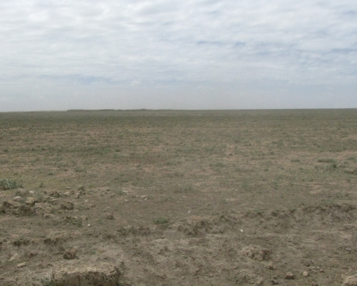
The plains during the dry season
Then in October or November, the short rains begin. These rains are variable and sometimes they don’t appear at all. But when they do, the plains green up and the grazers swarm in, only to retreat to the savanna edge again in December when there is sometimes a short dry lull before the long rains begin once more.

Mean monthly rainfall in the camera trap area of Serengeti
Fire!
Maybe you’ve seen fire in some of the images you’ve classified and thought “oh no!”

Fire is actually an important component of savanna ecosystems. Fire kills young trees and seedlings, reducing the number of big adult trees that grow over time. Since trees compete with grasses for light and soil moisture, fire actually helps the grasses and keeps the savannas open.
Dr. Rico Holdo, a professor at the University of Missouri, and his colleagues modeled and wrote about the interactions of fire, rain, grasses, trees, and the various animals in the Serengeti. The interactions get complicated quickly, but I’ll try to give you a run-down of how they see fire acting in this ecosystem.
First, as I’ve mentioned, fire suppresses trees and encourages grasses. If you have both fire and rain, but no animals, then something interesting happens: the rain encourages the trees, but it encourages the grasses, too. As the grasses get taller, there is more fuel for fire, and the fires become more widespread and more damaging. These fiercer fires really hurt the trees – in fact, the damage from fires (because of more rain) is more important than the extra boost the trees get directly from the rain. So more rain actually means fewer trees.
With me so far? We’re now going to throw animals into the mix – well, at least some of the animals. Let’s talk about the grazers. The grazers eat the grass, and this reduces the fuel available to fire. If you have a lot of grazers, like we do in the Serengeti, the grass height is reduced a lot. That means fewer fires and that rain once again helps the trees. Further, many of the grazers are migratory and move around the landscape a lot. They don’t eat the savanna grasses in a neat, tidy, organized way. Instead, they create a patchy mosaic of grass heights, and with those different grass heights come different susceptibility of patches of grass to burn.
With rain and fire and grazers, we now have a landscape of grasses of different lengths, patchy fires, and some areas dense with trees and some areas with fewer trees. All that variation means more diversity – more diversity of the grasses, plants, and trees, and more diversity of the animals that rely on them.
All that diversity due, in part, to fire.
You can read the scientific paper by Dr. Holdo and his colleagues here:
Holdo, Ricardo M., Robert D. Holt, and John M. Fryxell. “Grazers, browsers, and fire influence the extent and spatial pattern of tree cover in the Serengeti.” Ecological Applications 19.1 (2009): 95-109.
